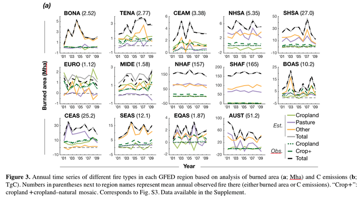
Abstract
The global extent of agriculture demands a thorough understanding of the ways it impacts the Earth system through the modification of both the physical and biological characteristics of the landscape as well as through emissions of greenhouse gases and aerosols. People use fire to manage cropland and pasture in many parts of the world, impacting both the timing and amount of fire. So far, much previous research into how these land uses affect fire regimes has focused on either individual small regions or global patterns at annual or decadal scales. Moreover, because pasture is not mapped globally at high resolution, the amount of fire associated with pasture has never been quantified as it has for cropland. The work presented here resolves the effects of agriculture – including pasture – on fire on a monthly basis for regions across the world, using globally gridded data on fire activity and land use at 0.25º resolution. The first global estimate of pasture-associated fire reveals that it accounts for over 40 % of annual burned area. Cropland, generally assumed to reduce fire occurrence, is shown to enhance or suppress fire at different times of year within individual regions. These results bridge important gaps in the understanding of how agriculture and associated management practices influence vegetation fire, enabling the next generation of vegetation and Earth system models more realistically incorporate these anthropogenic effects.